SUMMARY
This is AI generated summarization, which may have errors. For context, always refer to the full article.
What’s the weather like in your area? Report the situation through Rappler’s Agos or tweet us at @rapplerdotcom.
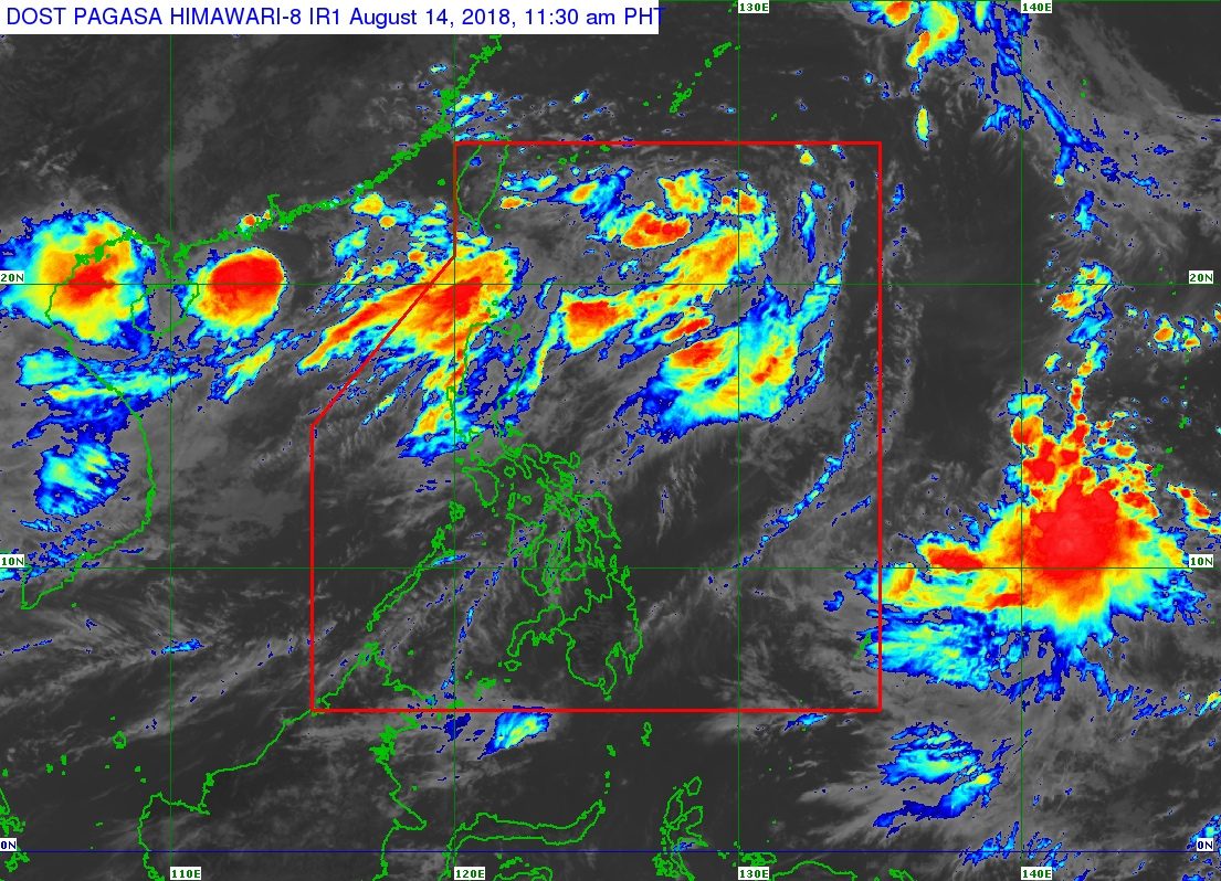
MANILA, Philippines – The low pressure area (LPA) inside the Philippine Area of Responsibility (PAR) is still enhancing the southwest monsoon or hanging habagat, but Severe Tropical Storm Leepi will remain outside PAR as it heads for Japan.
In a bulletin issued 11 am on Tuesday, August 14, the Philippine Atmospheric, Geophysical, and Astronomical Services Administration (PAGASA) said the LPA is already 785 kilometers east northeast of Basco, Batanes.
This LPA only has a slim chance of developing into a tropical depression, but it is making the southwest monsoon stronger.
Scattered to widespread monsoon rains are being experienced in the Ilocos Region, the Cordillera Administrative Region, Batanes, the Babuyan Group of Islands, Zambales, and Bataan.
There’s also light to heavy rain in Metro Manila, Calabarzon, and the rest of Central Luzon. (READ: FAST FACTS: Tropical cyclones, rainfall advisories)
PAGASA advised residents of these areas to stay on alert for floods and landslides. Massive floods already hit parts of Metro Manila and Rizal last weekend, after the enhanced southwest monsoon dumped more than half of August’s expected rainfall in just one day. (READ: #FloodPH: Things to do when you’re trapped, in need of rescue)
Classes in some areas are still suspended for Tuesday. (READ: #WalangPasok: Class suspensions, Tuesday, August 14)
A gale warning was also issued at 5 am for Batanes, the Babuyan Group of Islands, Ilocos Norte, Ilocos Sur, La Union, Pangasinan, Zambales, Bataan, Occidental Mindoro and the western coast of Batangas.
Seas off those areas are rough to very rough, with wave heights reaching 2.6 meters to 4.5 meters.
PAGASA advised fishermen and others with small vessels not to set sail in areas covered by the gale warning. Larger vessels should watch out for big waves.
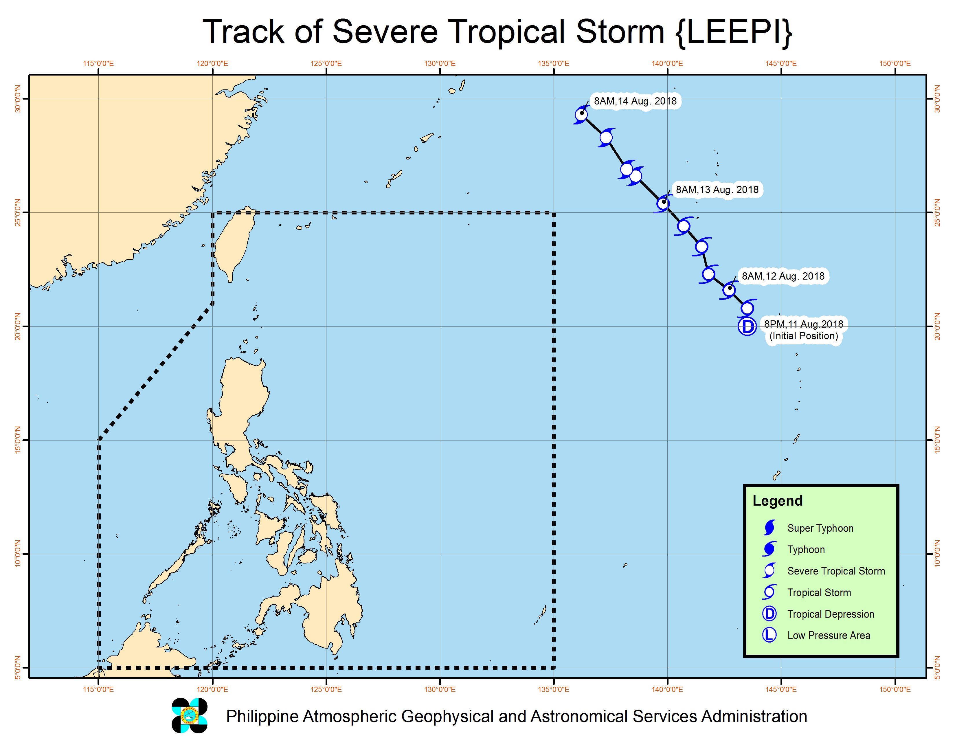
Leepi, Bebinca
Meanwhile, Severe Tropical Storm Leepi is now located 1,740 kilometers northeast of extreme Northern Luzon, moving northwest toward Kyushu, Japan, at 25 kilometers per hour (km/h).
Leepi still has maximum winds of 90 km/h and gustiness of up to 115 km/h. But PAGASA noted that the severe tropical storm has no direct impact on any part of the country, and based on its direction, will not enter PAR.
There’s also Tropical Storm Bebinca outside PAR, located 810 kilometers west northwest of Laoag City, Ilocos Norte, and slowly moving east southeast.
Bebinca continues to have maximum winds of 65 km/h and gustiness of up to 80 km/h. Like Leepi, it will not enter PAR.
So far, the Philippines has had 11 tropical cyclones in 2018. The country usually gets an average of 20 tropical cyclones per year. (READ: LIST: PAGASA’s names for tropical cyclones in 2018)
PAGASA declared the start of the rainy season last June 8. – Rappler.com
Add a comment
How does this make you feel?
There are no comments yet. Add your comment to start the conversation.