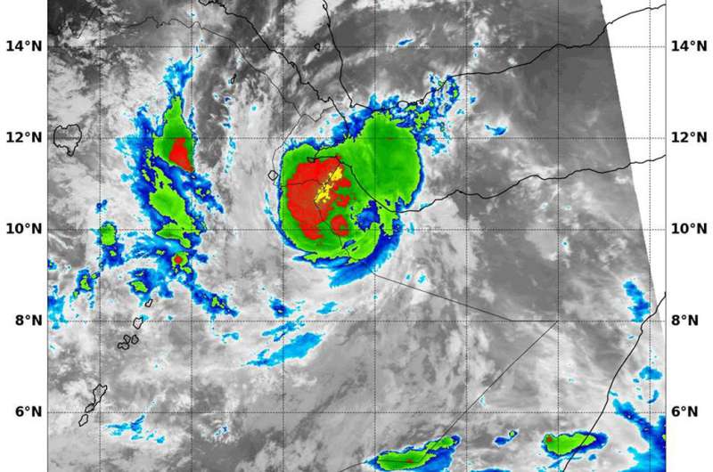
NASA sees Tropical Cyclone Sagar's landfall

The final bulletin on Tropical Cyclone Sagar was issued at 11 a.m. EDT (1500 UTC) on May 19. By that time, Sagar had made landfall in Somalia. NASA's Terra satellite captured an infrared image of the storm as it was making landfall.
Sagar's center was located over land, near 10.3 degrees north latitude and 43.7 degrees east longitude, about 88 miles south-southeast of Djibouti City, Djibouti. Sagar was moving to the southwest at 8 mph (7 knots/12.9 kph) and maintained maximum sustained winds near 57.5 mph (50 knots/92.6 kph).
At 2:45 p.m. EDT (1945 UTC) on May 19, the Moderate Resolution Imaging Spectroradiometer or MODIS instrument that flies aboard NASA's Terra satellite gathered infrared data on the land falling storm. Infrared data provides temperature information. MODIS revealed a few very powerful thunderstorms northwest of the center where cloud top temperatures were as cold as minus 80 degrees Fahrenheit (minus 62.2 Celsius). NASA research has shown that cloud tops with temperatures that cold were high in the troposphere and have the ability to generate heavy rain.
By May 21, Sagar had dissipated over land.
Provided by NASA's Goddard Space Flight Center


