Queensland towns swamped as year’s worth of rain falls
Towns have copped more than a year’s worth of rain in as little as a week, with warnings even more is on the way.
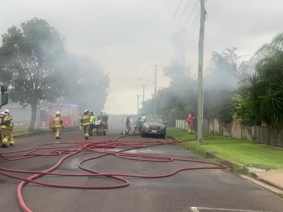
Firefighters injured in horror Queensland home blaze |
Environment
Don't miss out on the headlines from Environment. Followed categories will be added to My News.
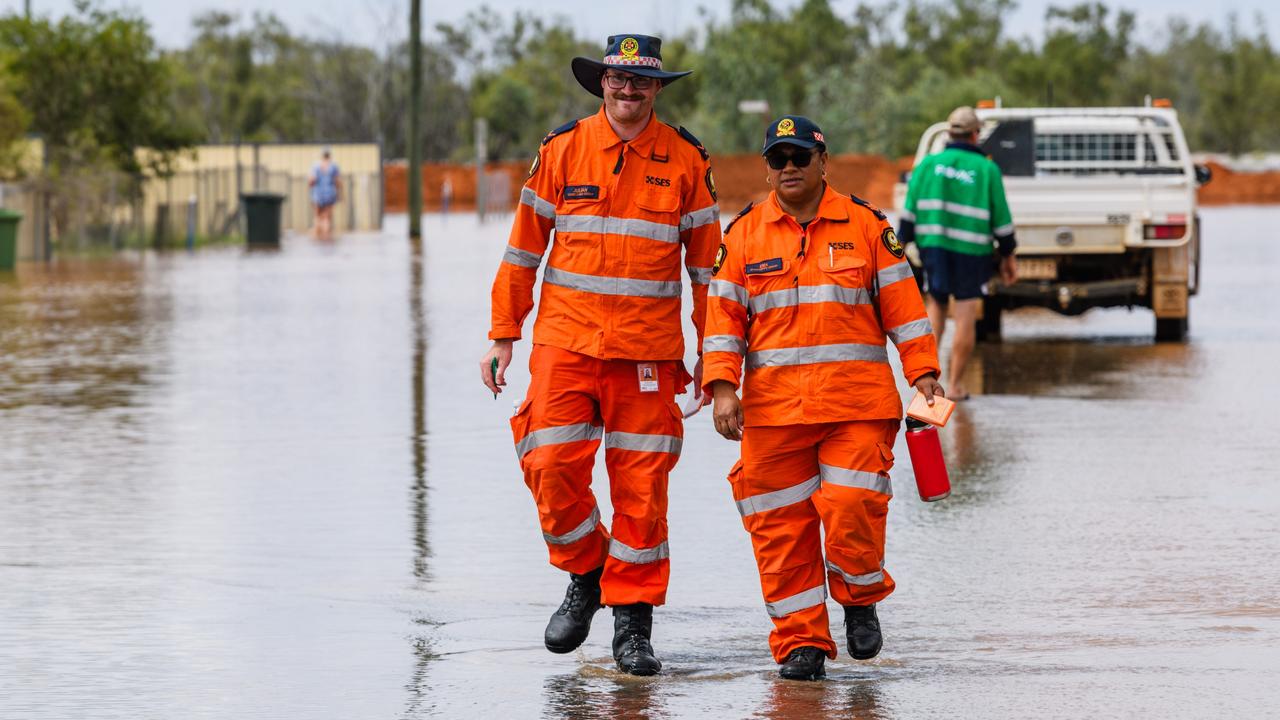
Queensland towns have been swamped with water as a week-long deluge dumps almost a year’s worth of rain within days in some areas.
The wild weather is expected to sweep through inland NSW in the coming days, as monsoonal winds bring unstable air and heavy rain and storms.
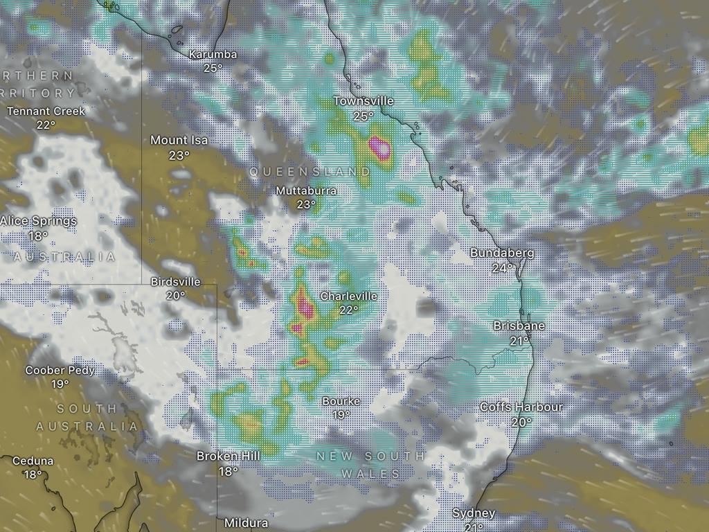
Parts of Queensland were “completely smashed” by a band of rain overnight, with 278mm of rain recorded at Teemburra Dam west of Mackay and between 50mm and 150mm along the Sunshine Coast.
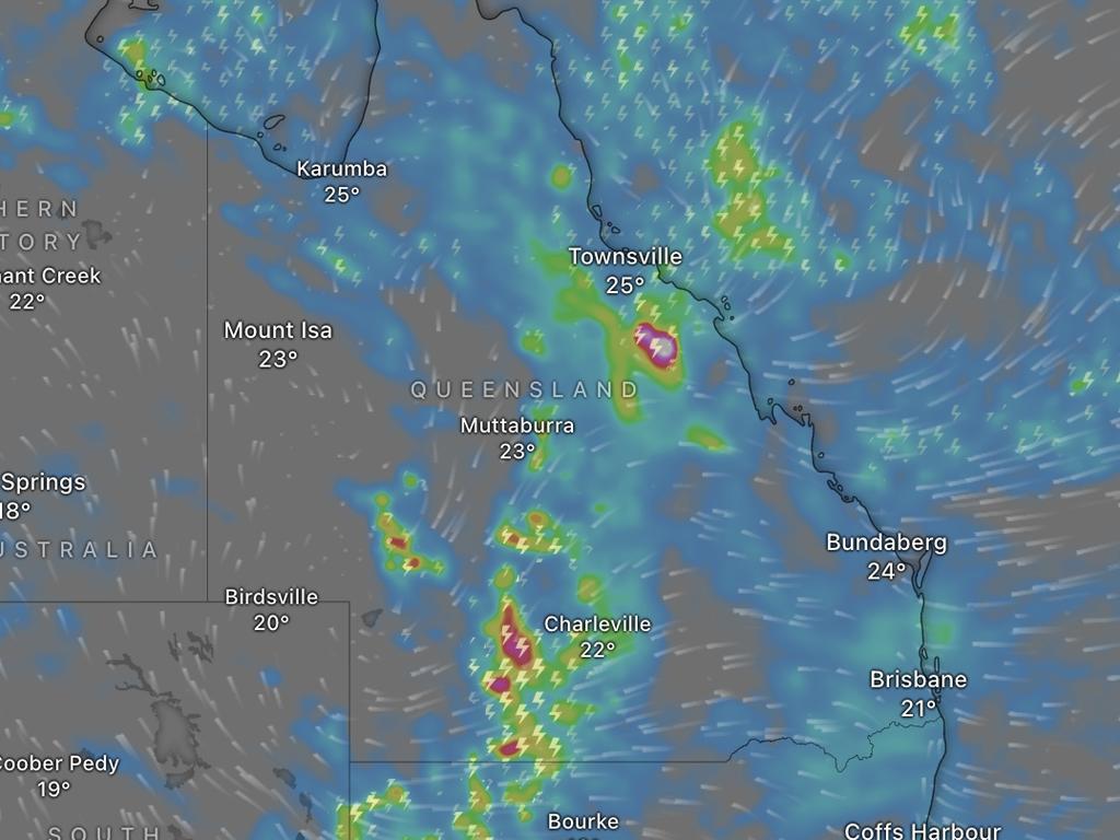
Some areas of western Queensland have endured more rain in a single month than they typically get in a year, causing widespread flooding across rural towns.
Among those was Birdsville, which has recorded 136mm of rain in March alone, compared to the 100mm of rain typically seen in an entire year.
Sky News Weather meteorologist Marina Neuman said the “very high” totals created the conditions for this kind of flooding.
Usually dry areas of rural Queensland have been swamped by the heavy rain, which is slowly spreading towards the state’s southeast and into NSW.
Severe weather warnings are in place for inland southern areas of Queensland, including parts of the Channel Country, Maranoa, Warrego, Darling Downs and the Granite Belt districts.
The Bureau of Meteorology’s Jonathan How said those areas could see 24-hour rain totals of up to 100mm, with isolated higher falls possible.
“This will, of course, lead to flash and further riverine flooding,” he said.
Thunderstorm warnings have also been issued for residents in northern regions.
Queensland Premier David Crisafulli told the ABC on Thursday some communities were “not out of the woods yet” as more rain is forecast to smash the area.
“There will be property owners who suffer significant damage, and they are going to need every bit of help to get back on their feet,” he said.
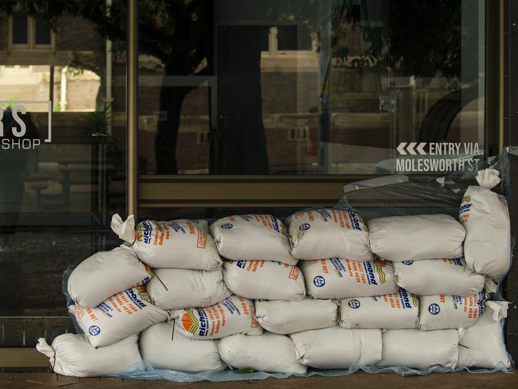
Preparations for further floods began on Thursday across parts of Queensland as the rain continues wreaking havoc on towns, with the Gold Coast City Council opening sandbagging stations in Bilinga, Burleigh Heads and Pimpana.
“There are still many people recovering from damage from ex-Cyclone Alfred,” a council spokesman wrote online.
“As catchments are already wet, conditions could change quickly, so it’s best to be prepared.”
The stations will be open until midday local time, per the council website.
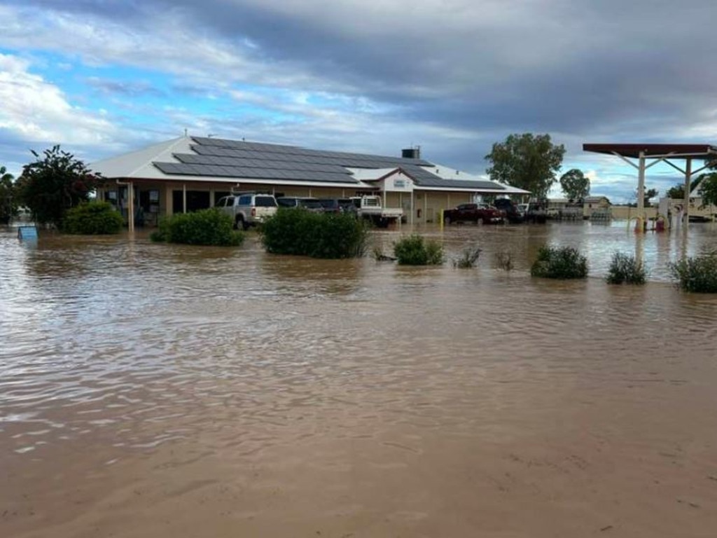
Townsville in the state’s north is again one of the most impacted areas by the widespread system, and is now on the verge of breaking its annual rainfall record of 2400mm, which has stood for 25 years.
The regional hub has already been smashed by rain and severe flooding this year.
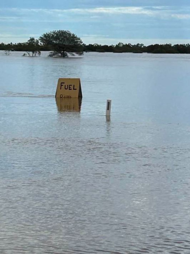
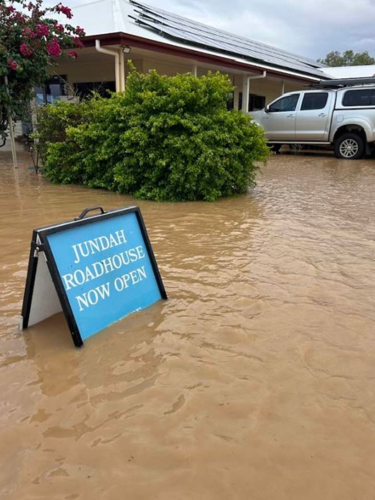
Further towards the state’s southwest, the town of Quilpie has recorded 500mm or 12 months’ worth of rainfall in the past six days alone.
A further 600mm has been recorded in the outback town of Stonehenge.
“It’s beat the record by about f--king half a metre, the largest ever flood we’ve had,” Stonehenge Pub owner Grant Champion told The Courier-Mail.
“Houses have been inundated with water on properties, there is a lot of dead livestock, fences and dams breaking.”
The Bureau has issued major flood warnings for the Pioneer, Bulloo, Georgina, Paroo, Thomson, Barco, Warrego and Western Rivers, with major warnings also impacting Eyre and Cooper Creeks.
“There is a lot of water flowing into these inland catchments, and this flooding is likely going to continue for quite an extended period of time,” Mr How said.
Cape River, Flinders and the Haughton River catchment have been flagged for moderate flooding, while there is a minor flood warning for the Burdekin and Cloncurry Rivers.
“The flooding situation is very dynamic, and warnings are being updated regularly,” Mr How said.
It’s not just residents in Queensland subjected to the heavy rainfall, with northern and central NSW facing a barrage of wet weather in the northwest before it shifts to the east on Saturday.
An initial minor flood warning was issued for the Lismore River ahead of heavy rain expected across the Wilsons River catchment through the weekend.
“As we see the rain and storms build across NSW, it is likely that further weather and flood warnings will be issued in the coming days,” Mr How said.
Conditions will be wet and soggy for most of central, northern and eastern NSW for most of the weekend, before finally easing off on Sunday.
Meanwhile, West Australians could be bracing for yet another cyclone, with tropical low 28U to potentially develop into a cyclone before crossing the Kimberley coast.
Currently 400km off the coast, the system is slowly moving towards land and is expected to hit the coast by late Friday or early Saturday.
Warnings have been issued from Troughton Island to Beagle Bay, including Derby.
Forecasts suggest the system will likely weaken once it reaches land.
Brisbane is expected to be cloudy with a very high chance of rain and a top of 25C on Friday.
Sydneysiders will likely see similar conditions with a maximum of 27C, with a slightly cooler 24C in Canberra.
Melbourne is predicted to have a warm and sunny morning with a top of 30C, and an even warmer 32C in Adelaide and 35C in Perth.
Bright and sunny weather with a high of 24C is on the cards in Hobart, with those in Darwin expecting a top of 32C.
Originally published as Queensland towns swamped as year’s worth of rain falls
‘Copped it’: Flooded residents sleeping in cars
Already isolated outback residents who are sleeping in their cars can expect more rain and flooding in the coming days.
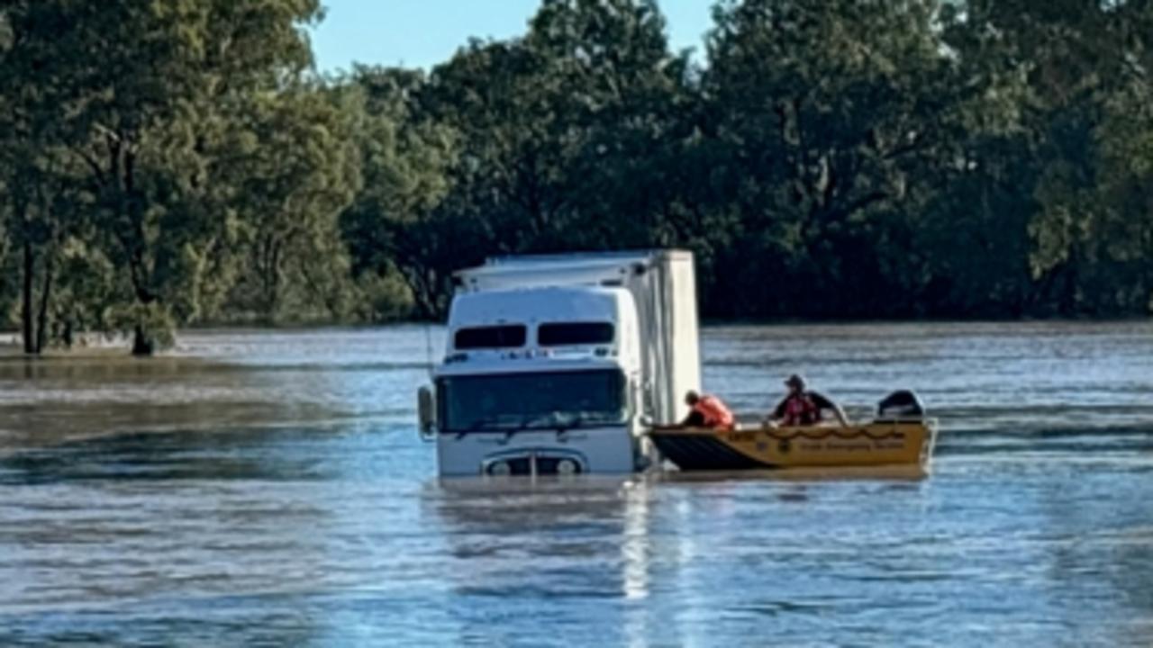
Truck driver rescued as floods smash Aussies
Incredible photos have captured the moment a truck driver was rescued from floodwaters, as severe weather smashes the country.
Trending now

How it unfolded: The five seconds before horror crash at Avalon Airshow

‘Jealous, low’: Troy Selwood call that changed VFL captain’s life

The silver lining in Cats’ frustrating fortnight in another recruiting win

Local group’s big plans for Balyang site