A tropical storm is threatening to whip the the British Isles with 60mph winds and beckon in an early autumn.
Almost as if an payback for the mini-heatwave Brits have been basking in in recent days, next week looks to be a washout.
Sunday, Monday and Tuesday will be dominated by overcast skies, heavy rain showers and thunderstorms.
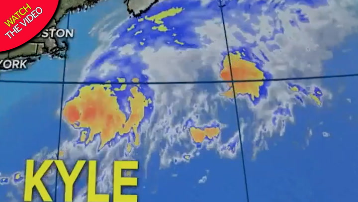
However, this may just be a warm up act for Tropical Storm Kyle, which is currently working its way across the atlantic.
The sizeable weather front is forecast to strengthen a low pressure area before potentially unleashing gails to the west of the Isles.
While it is currently unclear whether Kyle will remain over the sea or hit the Irish coast and then move further east, the storm has the potential unleash some serious gails.
Winds as strong as 60mph could hit the west of the Isles.
Along with them could be some comparatively chilly temperatures.
Cool 17-24C highs in the coming week will be 10C lower than last week's record 34C six-day run.
The Met Office has forecast further wet and windy spells during the rest of August, along with average temperatures.
Autumn does not officially begin until September 1.
Met Office forecaster Marco Petagna said: "Remnants of tropical storms can get caught in the jet stream and bring premature autumnal weather to the UK.
"Computer models show Tropical Storm Kyle doing just this.
"Kyle may generate a vigorous area of low pressure and bring wet and windy weather to the UK on Thursday into Friday.
"It's a big change in the weather."
The Weather Outlook forecaster Brian Gaze offered a more gloomy forecast.
He said: "It's payback time after the heatwave.
"The storm will bring us back to reality, with a taste of early autumn seeing washouts for families on holidays, with gusts of 55mph in the West and up to 40mph in exposed parts of the South."
The eight-day run of Met Office thunderstorm warnings which began last Monday is thought to be the longest run on record of thunderstorm warnings each day.
It was triggered by the longest 'extreme heatwave' since Met Office records began 179 years ago in 1841, with 34C daily for six days.
That is an even longer run than 1976's drought-hit summer, which saw standpipes on the streets.