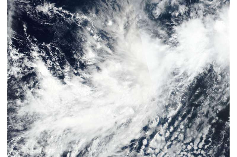
NASA-NOAA satellite finds Tropical Storm Mario more out of shape

NASA-NOAA's Suomi NPP satellite imagery revealed Tropical Storm Mario appeared to be losing its rounded shape in the Eastern Pacific Ocean.
When tropical cyclones begin to lose their shape and appear less circular, it is generally an indication of a storm that is weakening. Circular storms can spin faster, just like a tire on a car. Once the tire loses its circular shape it can't rotate as fast.
The Visible Infrared Imaging Radiometer Suite (VIIRS) instrument aboard Suomi NPP provided a visible image of Mario on Sept. 18 at 5:36 p.m. EDT (2136 UTC) that indicated wind shear was affecting the storm as it did not appear circular as a result of wind shear. NPP data is used by forecasters at NOAA's National Hurricane Center to assess factors of the storm that include structure and strength.
NASA's Aqua satellite also passed over Mario and provided cloud top temperature data. Aqua showed Mario contained some powerful thunderstorms stretching high into the troposphere with cloud top temperatures as cold as or colder than 220 Kelvin (minus 63 degrees Fahrenheit / minus 53 degrees Celsius). NASA research has shown that storms with cloud top temperatures that cold can produce heavy rainfall.
NHC forecasters also utilized data to determine moderate easterly wind shear, associated at least in part with outflow from Mario's larger sibling (Lorena) to the east, has prevented the tropical storm from strengthening at a faster rate.
In general, wind shear is a measure of how the speed and direction of winds change with altitude. Tropical cyclones are like rotating cylinders of winds. Each level needs to be stacked on top each other vertically in order for the storm to maintain strength or intensify. Wind shear occurs when winds at different levels of the atmosphere push against the rotating cylinder of winds, weakening the rotation by pushing it apart at different levels.
During the morning of Sept. 19, microwave and first-light visible imagery suggest that the low-level center of Mario may be displaced to the east of most of its strongest thunderstorms, indicating a weakening storm.
NOAA's National Hurricane Center or NHC said, "At 11 a.m. EDT (1500 UTC), the center of Tropical Storm Mario was located near latitude 16.5 degrees north and longitude 111.5 degrees west. Mario is moving toward the north near 7 mph (11 kph). Maximum sustained winds are near 65 mph (100 kph) with higher gusts. Little change in strength is forecast during the next several days.
Mario is currently embedded within low- to mid-layer southwesterly flow and this should cause the cyclone to move generally northeastward or north-northeastward for the next day or two. What happens after that depends largely on Lorena.
Provided by NASA's Goddard Space Flight Center


