SUMMARY
This is AI generated summarization, which may have errors. For context, always refer to the full article.
What’s the weather like in your area? Report the situation through Rappler’s Agos or tweet us at @rapplerdotcom.
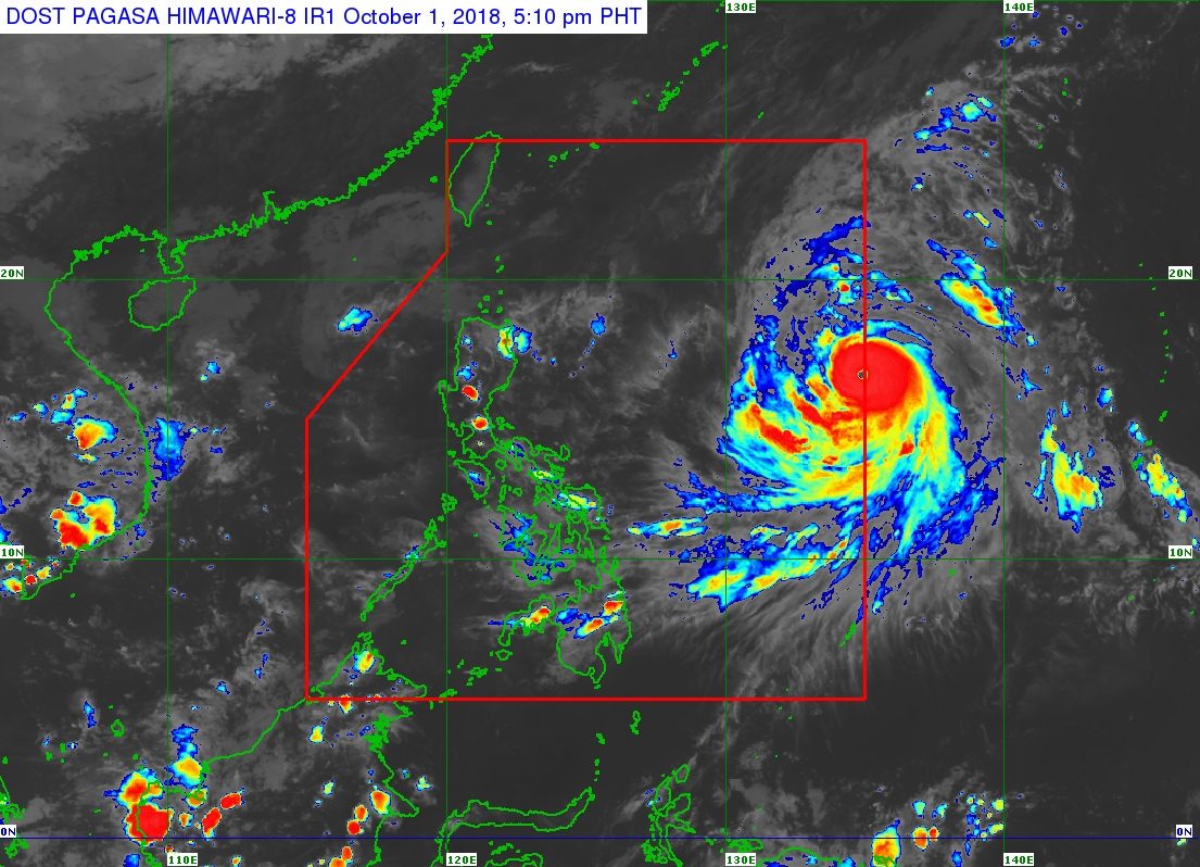
MANILA, Philippines – The typhoon with the international name Kong-rey entered the Philippine Area of Responsibility (PAR) on Monday afternoon, October 1. It has been given the local name Queenie.
Queenie is the Philippines’ 17th tropical cyclone for 2018. The country usually gets an average of 20 tropical cyclones per year. (READ: LIST: PAGASA’s names for tropical cyclones in 2018)
In a press briefing at 5 pm on Monday, the Philippine Atmospheric, Geophysical, and Astronomical Services Administration (PAGASA) said Queenie intensified further as it entered PAR.
The typhoon now has maximum winds of 160 kilometers per hour (km/h) from the previous 145 km/h and gustiness of up to 195 km/h from the previous 180 km/h.
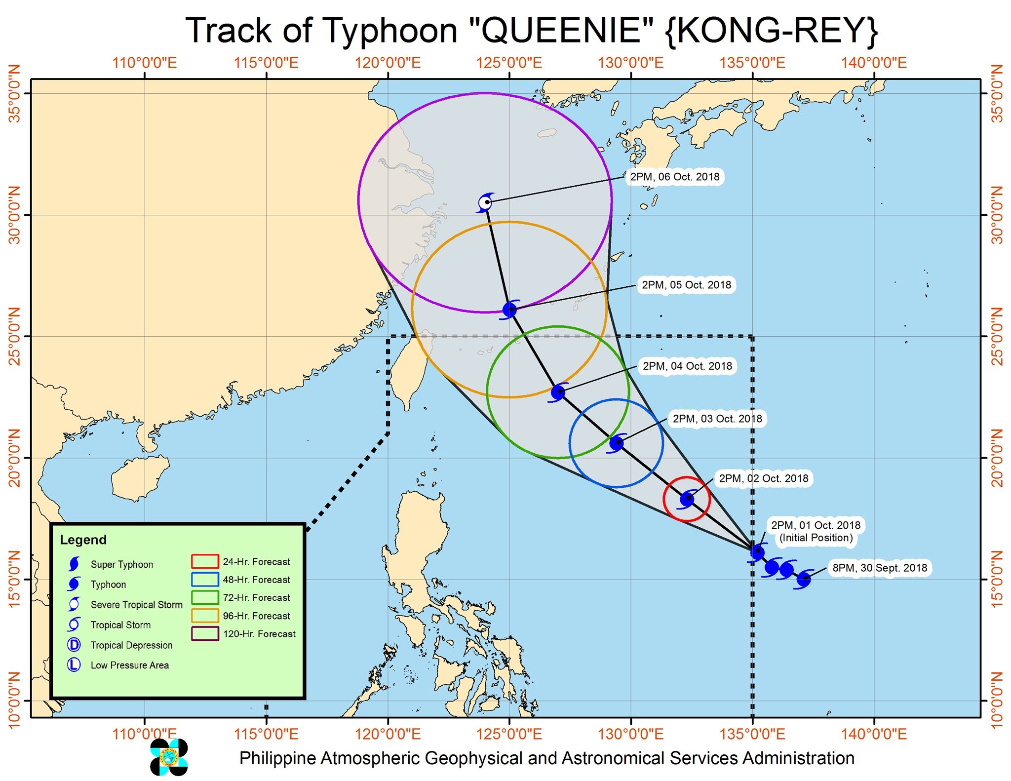
Queenie is located 1,385 kilometers east of Casiguran, Aurora, moving northwest at 15 km/h. (READ: FAST FACTS: Tropical cyclones, rainfall advisories)
The typhoon is not expected to make landfall in the country, and will instead head for the southern part of Japan. There are also no areas under tropical cyclone warning signals.
But PAGASA warned that Queenie’s trough or extension could bring rain to parts of Luzon.
PAGASA explained that Queenie will be nearest Calayan and the Babuyan Group of Islands from Wednesday, October 3, to Thursday, October 4.
The typhoon’s trough may trigger light to moderate rain in Benguet, Nueva Vizcaya, Quirino, and Aurora until Thursday. In mid-September, deadly landslides caused by Typhoon Ompong (Mangkhut) had hit Benguet.
“May nakikita tayong thunderstorms…kaya delikado pa rin kung biglang bubuhos ang pag-ulan…. Kailangan mag-ingat pa rin sila dahil hindi pa totally natutuyo ‘yung areas [na] naapektuhan nitong nakaraang mga bagyo kagaya ni Ompong,” said PAGASA Weather Division Chief Esperanza Cayanan in the press briefing.
(We’re expecting thunderstorms…so it’ll still be dangerous if the rainfall becomes heavy…. The people still need to take precautions because areas affected by past tropical cyclones like Ompong are still saturated.)
Sea travel is also risky in the seaboards of Northern Luzon.
A gale warning was issued at 5 pm on Monday for Batanes, Calayan, the Babuyan Group of Islands, the northern coast of Cagayan, and the northern coast of Ilocos Norte.
Seas off those areas are rough to very rough, with wave heights reaching 2.8 meters to 4.5 meters.
PAGASA advised fishermen and others with small vessels not to set sail in areas covered by the gale warning. Larger vessels should watch out for big waves.
Based on its latest forecast track, Queenie is expected to leave PAR on Friday, October 5.
PAGASA also explained that the southwest monsoon or hanging habagat is weakening, as the Philippines will shift to the period of the northeast monsoon or hanging amihan in October.
The southwest monsoon is characterized by warm, moist winds which cause rain in the western part of the country, while the northeast monsoon is characterized by cold winds which bring rain to the eastern side of the country.
PAGASA declared the start of the rainy season last June 8. – Rappler.com
Add a comment
How does this make you feel?
There are no comments yet. Add your comment to start the conversation.